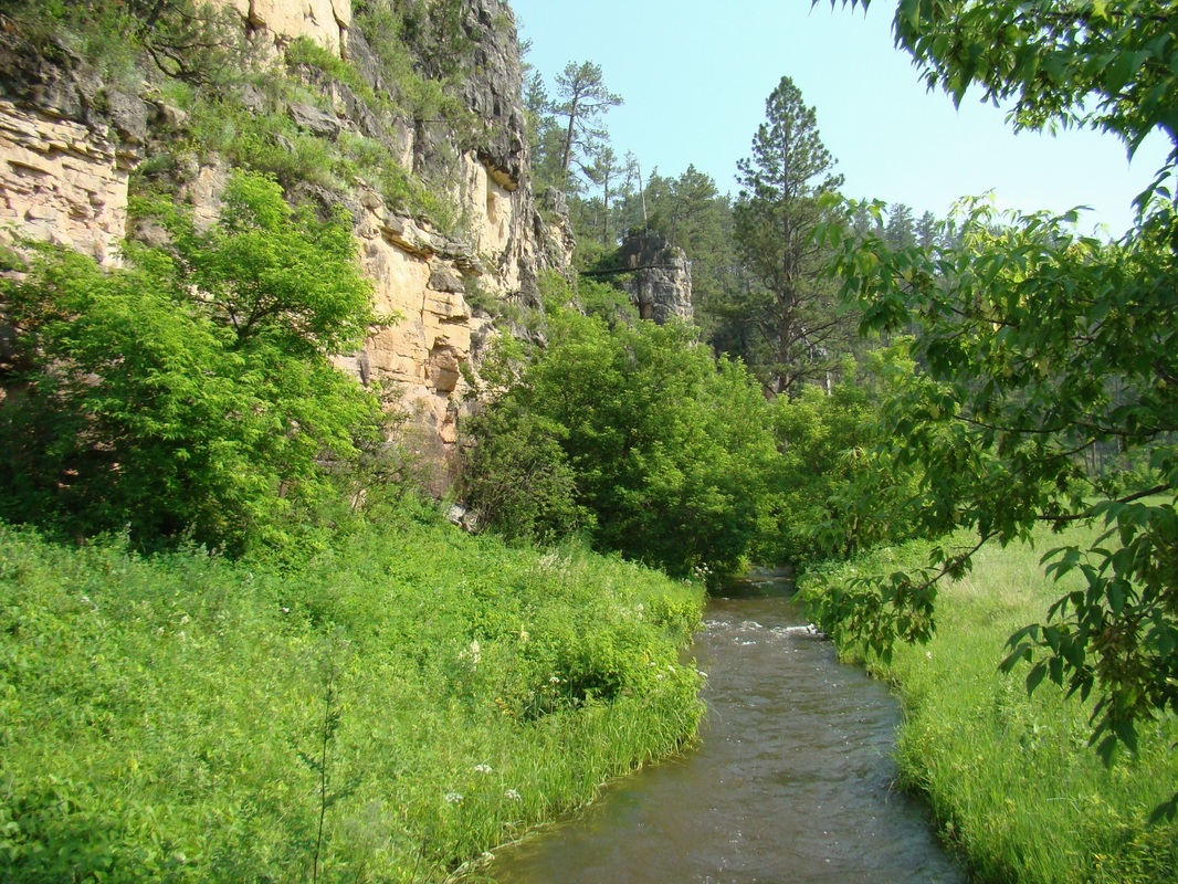
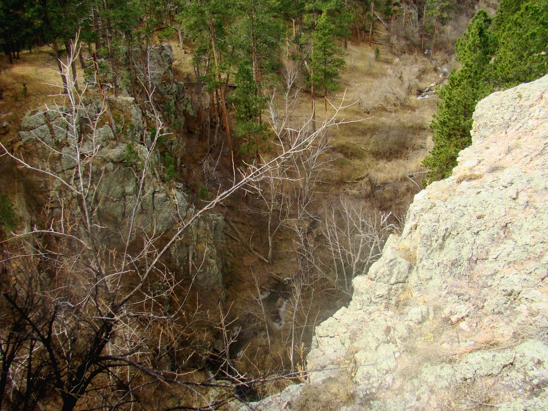
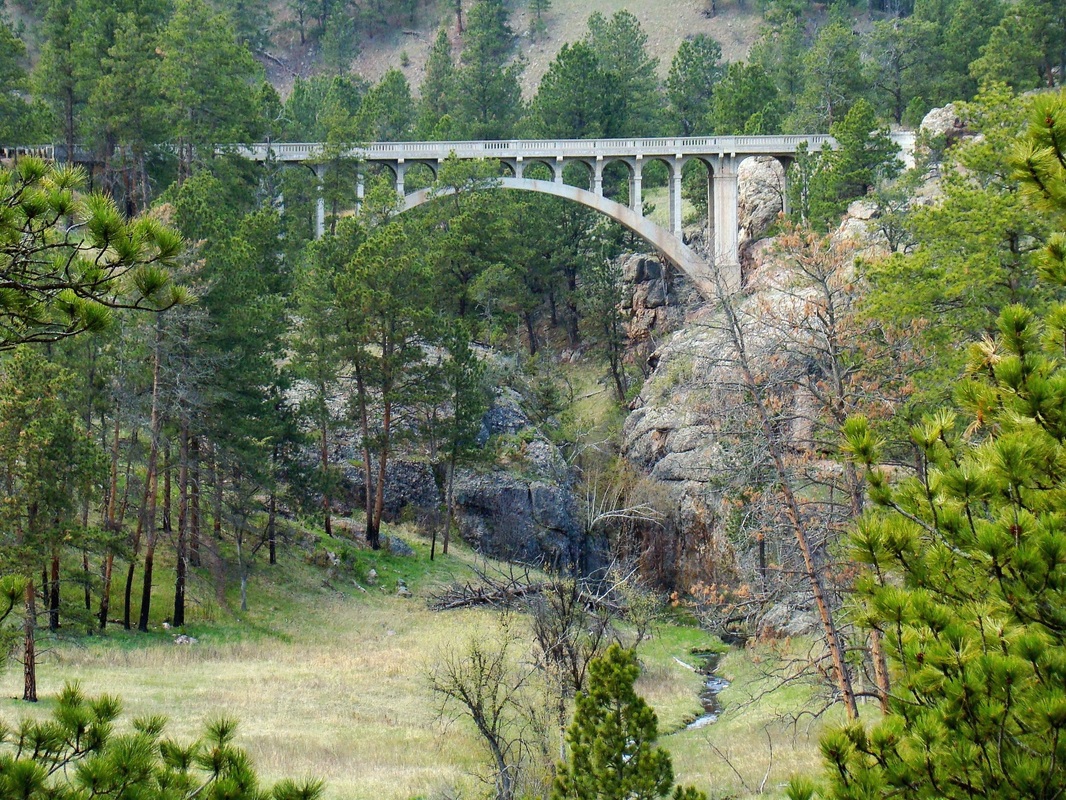
Beaver Creek Canyon
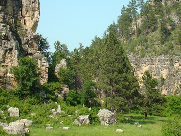
Wind Cave National Park is one of the best places in the Black Hills to find publicly-accessible canyons to explore, and Beaver Creek Canyon is the largest canyon network in the park. Beaver Creek has about 8 miles of canyon within the national park, but only about 4.7 miles of the canyon are currently accessible to the public. The rest is in the newly-acquired Sanson Ranch addition, which is temporarily off-limits to the public. However, summer hikes led by Wind Cave Park employees onto the old Sanson Ranch are open to the public. For more information about those hikes, call (605) 745-1134. For more about Wind Cave National Park, you can visit their website: Wind Cave National Park
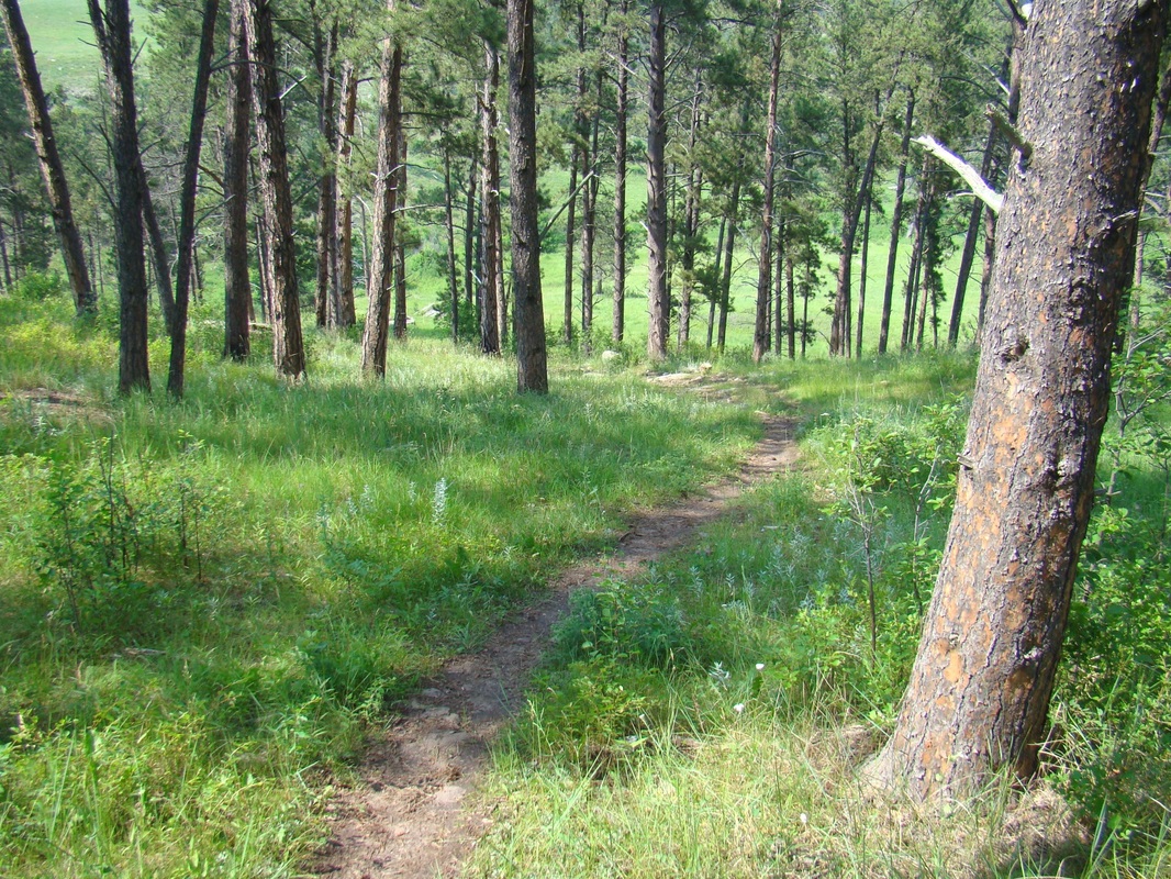
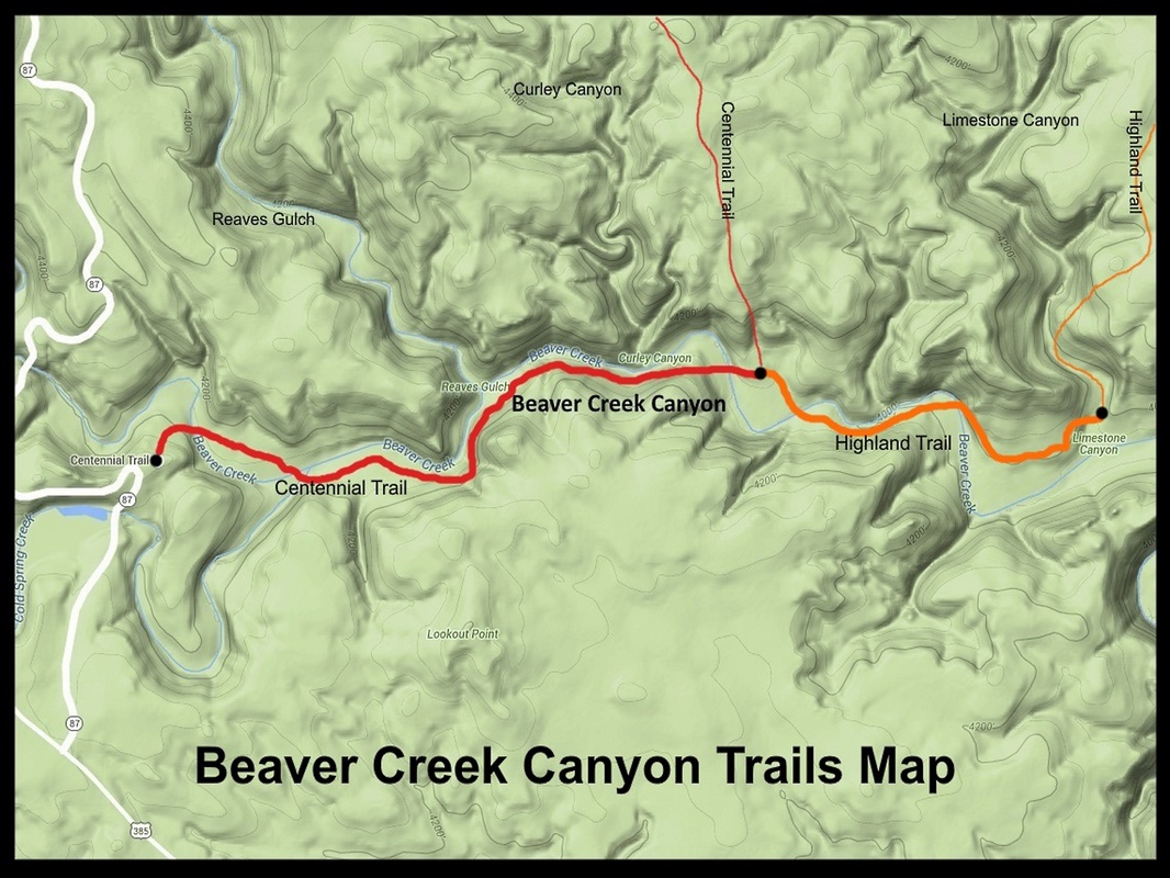
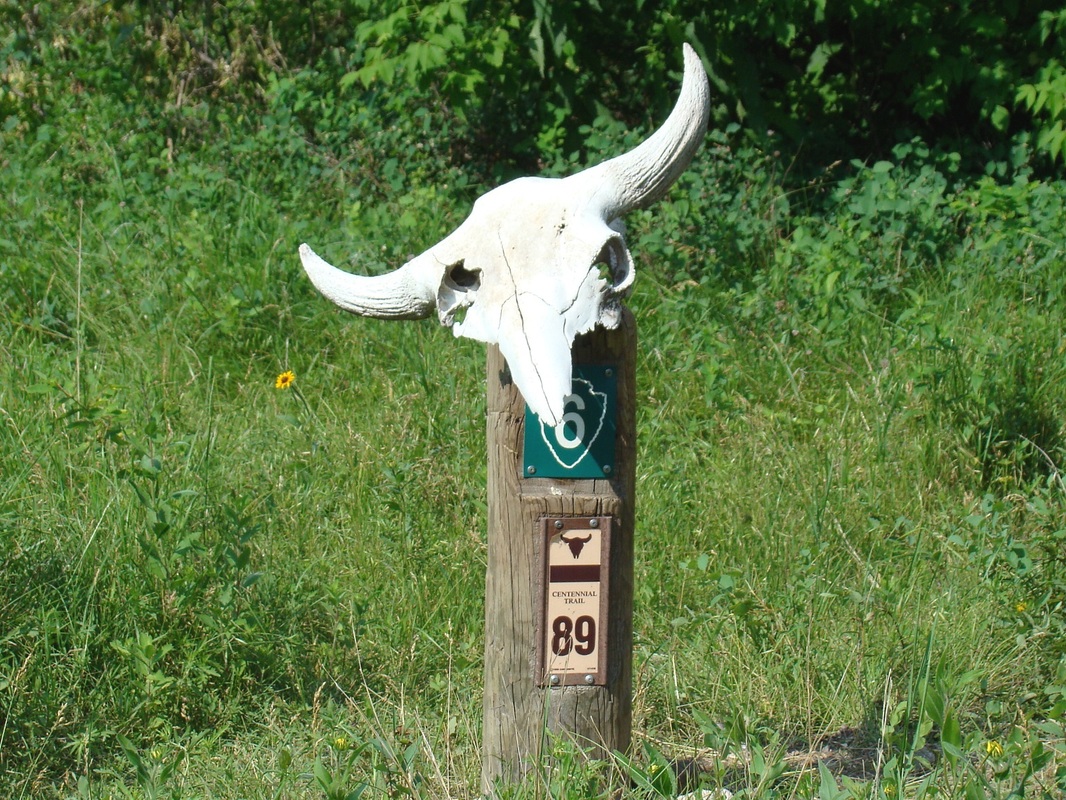
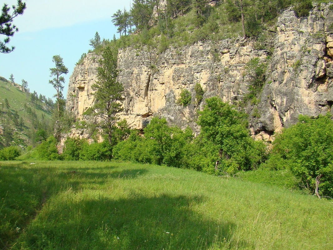
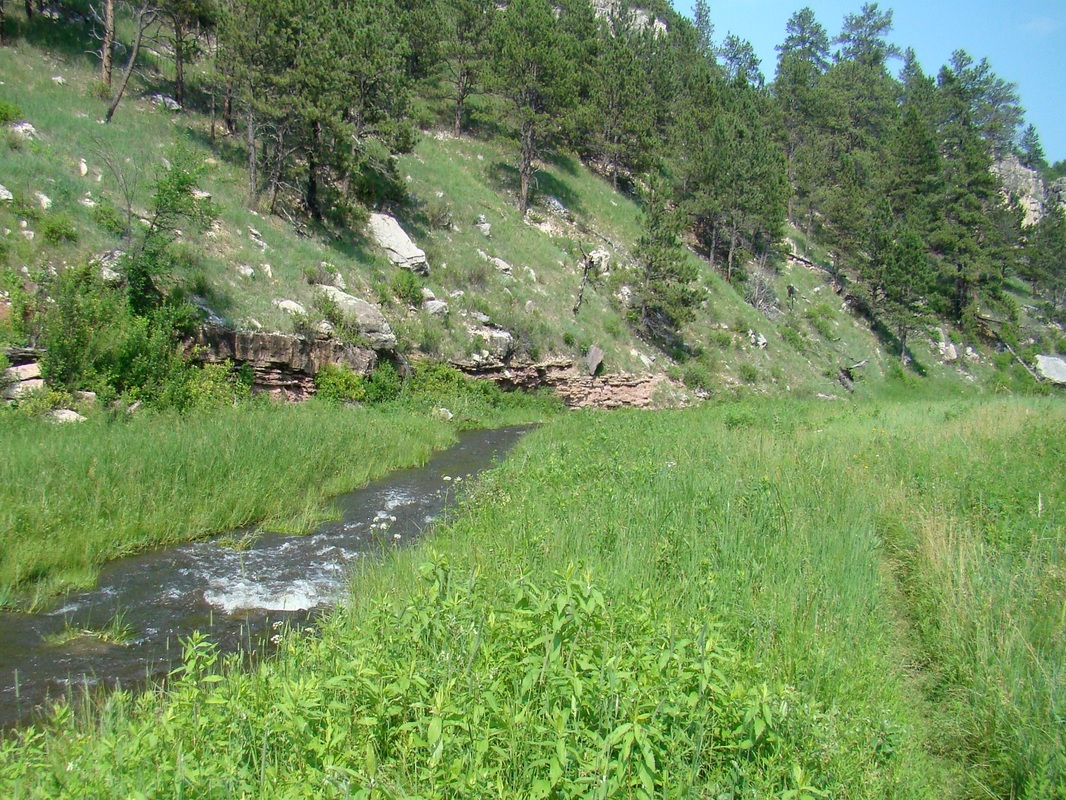
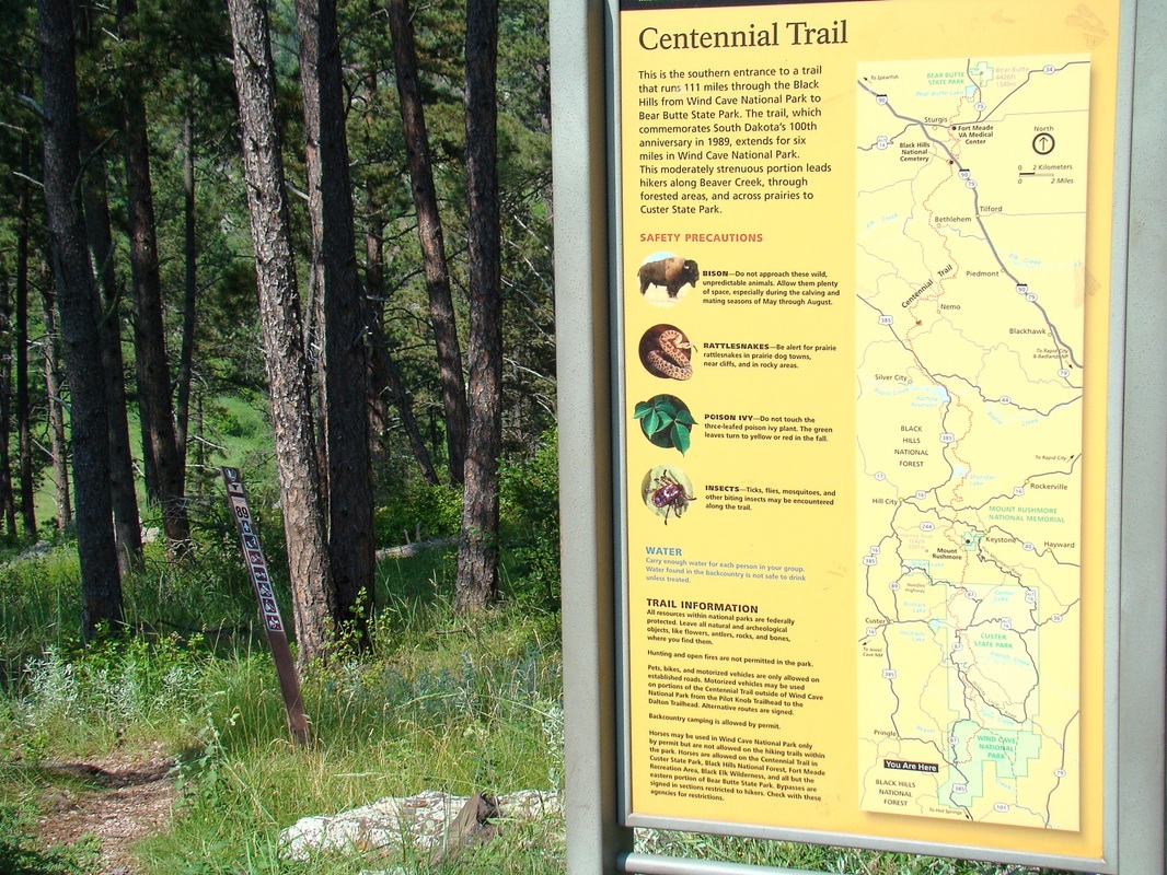
Because we like to focus on defined routes, we would point out that the only trail routes through the canyon would be a combination of the Centennial Trail and the Highland Trail, for a total of 2.7 miles (one-way). Side canyons along these trails include Limestone Canyon, Reaves Gulch and Curley Canyon. Beaver Creek Canyon is wider than Wind Cave Canyon a few miles south. The Centennial Trail follows the course of Beaver Creek for about 1.7 miles before veering to the north. At this point, there is a junction with the Highland Trail, which follows Beaver Creek for another mile east before veering north into Limestone Canyon for a short ways, and then north out of that canyon. At Limestone Canyon, you have reached the limit of the exploration of Beaver Creek Canyon by trail.
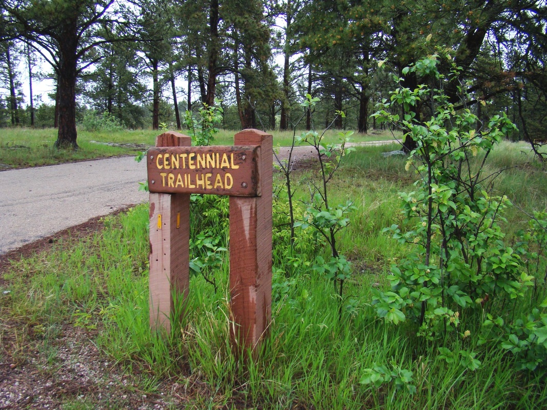
Beaver Creek Canyon is usually accessed from Highway 385, which runs through the western half of Wind Cave National Park. The Centennial Trailhead provides the best access point and is approximately 13 miles north of Hot Springs, along Highway 87. To download PDF maps of these trails in the national park, please click on the link below:
Wind Cave Canyon Trail Maps
Because we like to focus on defined routes, we would point out that the only trail routes through the canyon would be a combination of the Centennial Trail and the Highland Trail, for a total of 2.7 miles (one-way). Side canyons along these trails include Limestone Canyon, Reaves Gulch and Curley Canyon. Beaver Creek Canyon is wider than Wind Cave Canyon a few miles south. The Centennial Trail follows the course of Beaver Creek for about 1.7 miles before veering to the north. At this point, there is a junction with the Highland Trail, which follows Beaver Creek for another mile east before veering north into Limestone Canyon for a short ways, and then north out of that canyon. At Limestone Canyon, you have reached the limit of the exploration of Beaver Creek Canyon by trail.
Beaver Creek Canyon is usually accessed from Highway 385, which runs through the western half of Wind Cave National Park. The Centennial Trailhead provides the best access point and is approximately 13 miles north of Hot Springs, along Highway 87. To download PDF maps of these trails in the national park, please click on the link below:
Wind Cave Canyon Trail Maps
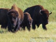
Caution: Hikers need to be aware of the bison dangers in the park and especially in the canyon. It is important to keep a safe distance from these unpredictable animals. Even though they can weigh up to a ton, they can move much faster than humans. There is often little shelter in the bottom of the canyon. May through August is the period that poses the greatest risks because that is bison mating season. Bison with calves are also very aggressive. For your own safety, please take your "close-up" photos with a telephoto lens.

Your word is a light to my feet and a lamp to my path. Psalm 119:105
