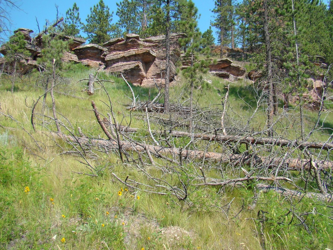
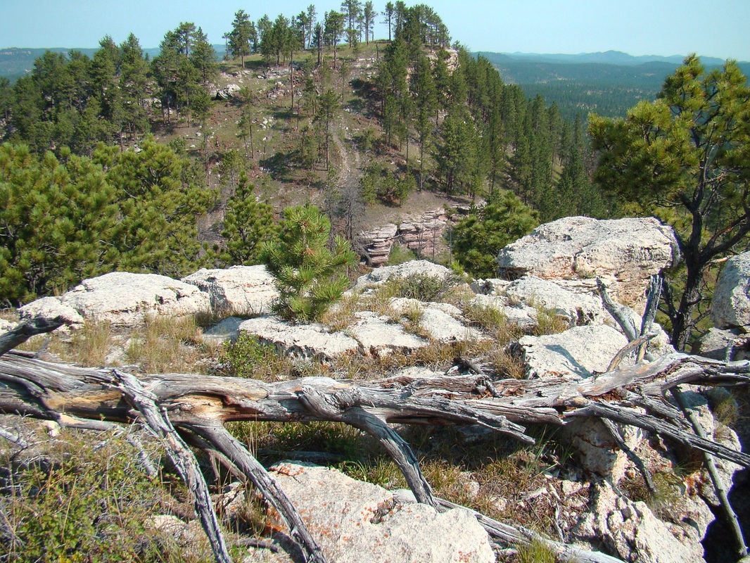
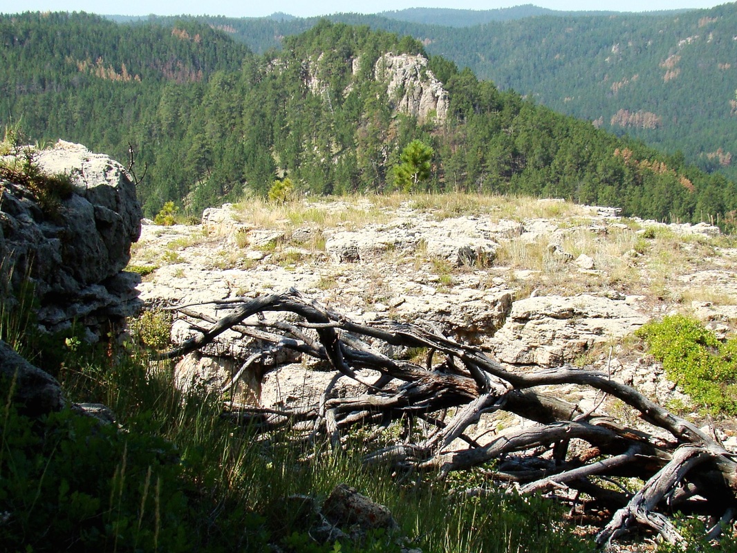
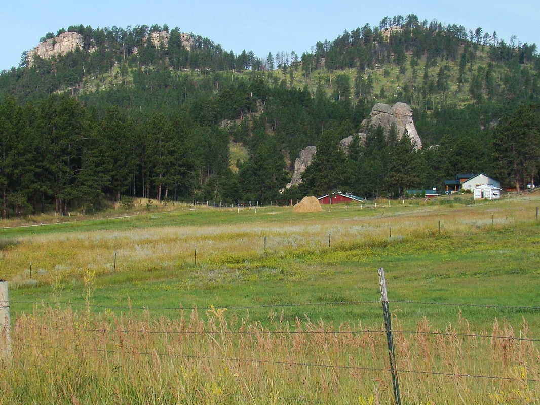
Twin Sisters (North & South)
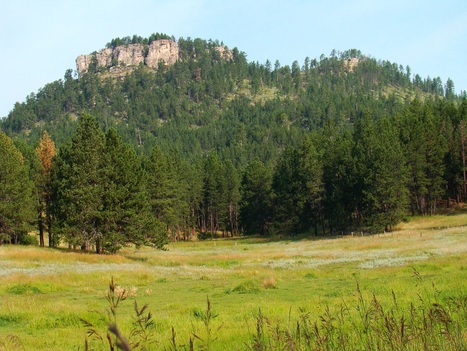
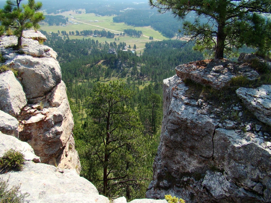
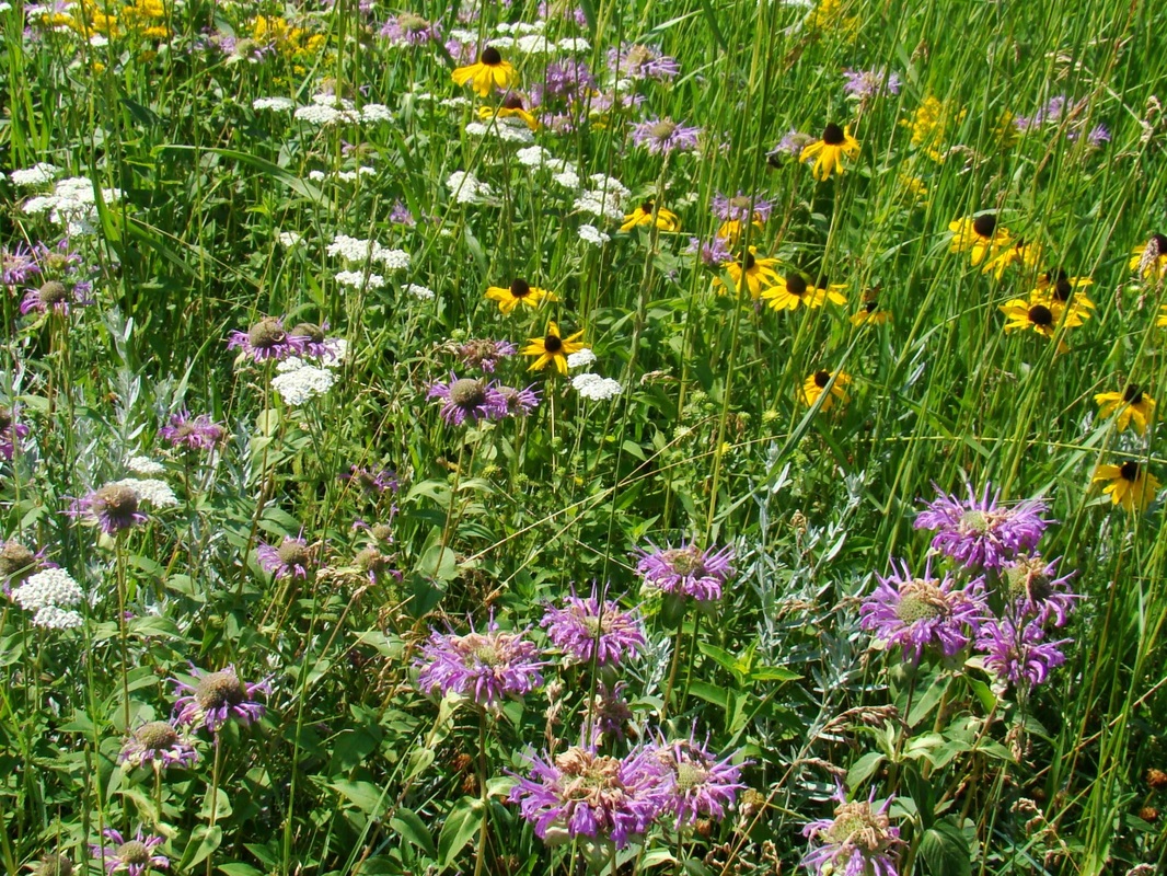
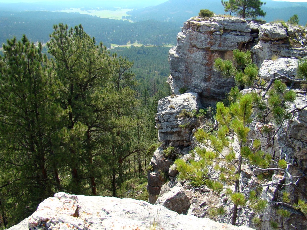
Twin Sisters offers hikers a chance of reaching two summits on one hiking outing. These conjoined summits are 8 miles southwest of Custer. They rise about 700 feet above nearby Fourmile Creek valley. Summit views from either peak are pretty clear, though there is some tree growth at each summit. Still, by carefully selecting your vantage point, you can see Black Elk Peak, Crazy Horse, Cathedral Spires, Mount Coolidge, Sylvan Peak, Buckhorn Mountain and other peaks. There are some beautiful rock formations on these summits, particularly on Twin Sisters South. At the eastern base of these peaks lies the old Helen Beryl Mine.
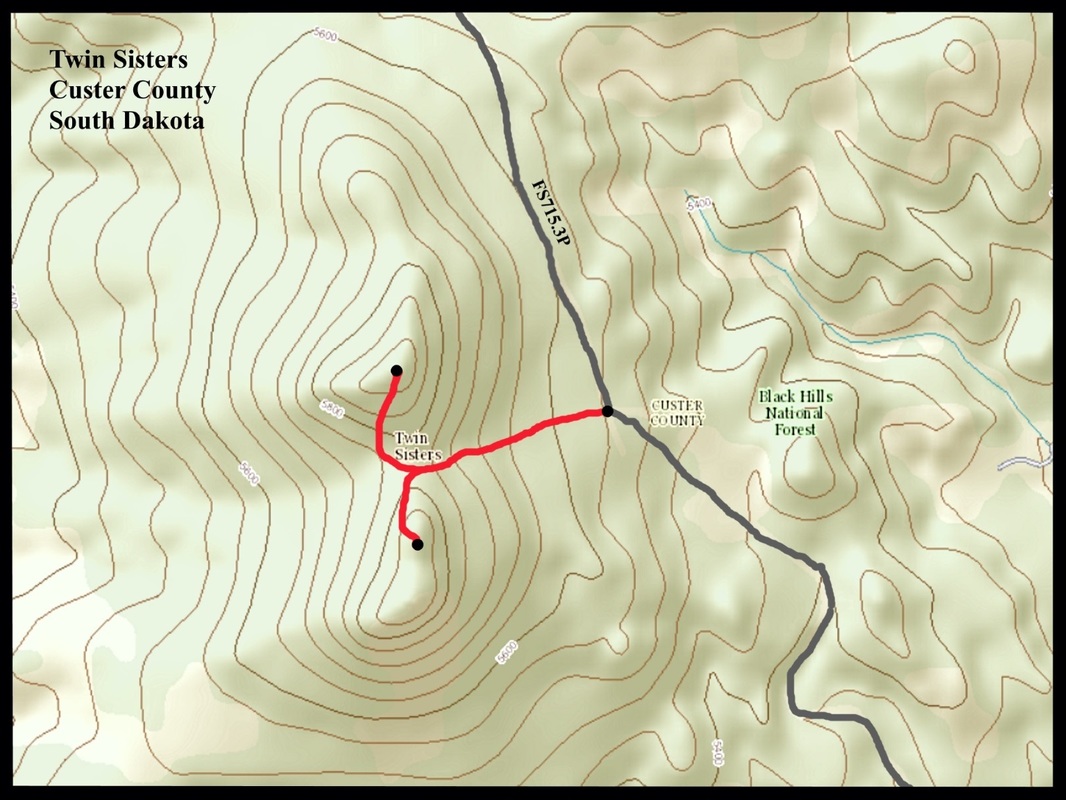
The best way to travel to Twin Sisters is by way of Highway 16 to Harry Mills Road, about 6 miles west of downtown Custer. At Harry Mills Road (Road 402 on forest service maps), go south 1 mile to Forest Service Road 402.1E. Go east on 402.1E about .9 mile, then turn right on Forest Service Road 402.1F. Follow that road for.4 mile to another junction. Once there, follow Road 715.3P south for about a half mile. Please note that these roads are mostly flat and not too rocky. While high clearance vehicles are always better on these back roads, a car could probably make this route, providing they watch for the occasional rock sticking up. Road 402.3P is rather narrow in places, so watch for enough space to pull over for safe and un-obstructive parking. In this general area, you will be on the east side of the saddle between Twin Sisters North and Twin Sisters South.
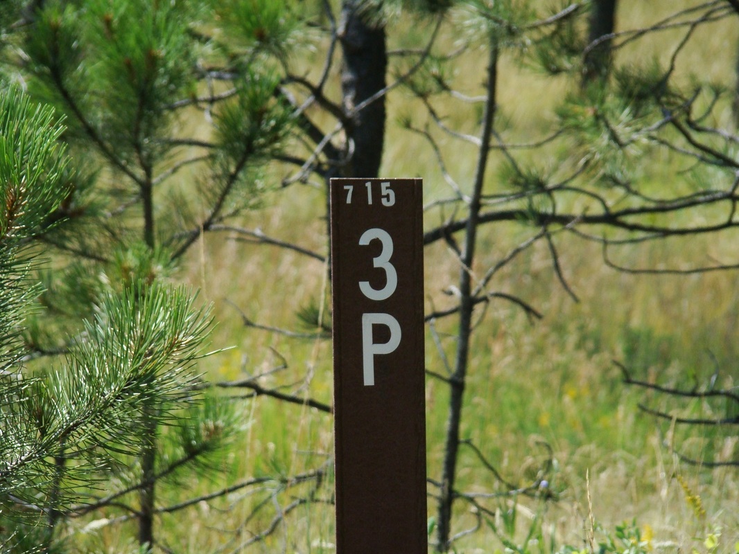
A note on map discrepancies: The National Forest Service issues a free Motor Vehicle Use Map for the Black Hills. For the most part, it is normally quite helpful. Here is one exception. Their map shows Road 402.1F as the road that is actually labeled “715.3P” (see photo). In reality, 402.1F goes around behind (west side) of Twin Sisters (which they label on their maps as “402.1D”. Additionally, Road 715.3P goes on further, intersecting several miles south with Road 715 (Pleasant Valley Road). Please be aware of this to avoid unnecessary extra travel.
There are no established trails on these peaks. As you ascend to either summit, the upper portions get somewhat steeper and both have a thick cover of pine needles. This makes footing a little slick at times. So, the best off-trail route seems to be up to the top of the saddle between the two peaks. The lower area below the saddle is more meadow-like, and also has the benefit of a little less deadfall. Once you are at the saddle, you will note some logging truck tracks up to the summit area of the north peak. This route pretty much sidesteps the pine needle problem. The south peak is rockier at the summit, so there are no logging truck tracks to follow. Line of sight will easily guide you, though. A map of the route from Forest Service Road 715.3P is included among the photos below. As with all off-trail hiking, please make sure you study the maps well before you go, then make mental notes of your surroundings as you ascend, turning around periodically to get a picture of what to watch for when you descend. It will help you avoid getting turned around or lost.
The best way to travel to Twin Sisters is by way of Highway 16 to Harry Mills Road, about 6 miles west of downtown Custer. At Harry Mills Road (Road 402 on forest service maps), go south 1 mile to Forest Service Road 402.1E. Go east on 402.1E about .9 mile, then turn right on Forest Service Road 402.1F. Follow that road for.4 mile to another junction. Once there, follow Road 715.3P south for about a half mile. Please note that these roads are mostly flat and not too rocky. While high clearance vehicles are always better on these back roads, a car could probably make this route, providing they watch for the occasional rock sticking up. Road 402.3P is rather narrow in places, so watch for enough space to pull over for safe and un-obstructive parking. In this general area, you will be on the east side of the saddle between Twin Sisters North and Twin Sisters South.
A note on map discrepancies: The National Forest Service issues a free Motor Vehicle Use Map for the Black Hills. For the most part, it is normally quite helpful. Here is one exception. Their map shows Road 402.1F as the road that is actually labeled “715.3P” (see photo). In reality, 402.1F goes around behind (west side) of Twin Sisters (which they label on their maps as “402.1D”. Additionally, Road 715.3P goes on further, intersecting several miles south with Road 715 (Pleasant Valley Road). Please be aware of this to avoid unnecessary extra travel.
There are no established trails on these peaks. As you ascend to either summit, the upper portions get somewhat steeper and both have a thick cover of pine needles. This makes footing a little slick at times. So, the best off-trail route seems to be up to the top of the saddle between the two peaks. The lower area below the saddle is more meadow-like, and also has the benefit of a little less deadfall. Once you are at the saddle, you will note some logging truck tracks up to the summit area of the north peak. This route pretty much sidesteps the pine needle problem. The south peak is rockier at the summit, so there are no logging truck tracks to follow. Line of sight will easily guide you, though. A map of the route from Forest Service Road 715.3P is included among the photos below. As with all off-trail hiking, please make sure you study the maps well before you go, then make mental notes of your surroundings as you ascend, turning around periodically to get a picture of what to watch for when you descend. It will help you avoid getting turned around or lost.


Blessed is the man who makes the LORD his trust, who does not turn to the proud, to those who go astray after a lie! Psalm 40:4
